Thursday, February 21, 2019

WINTER HIKE: GORGEOUS VIEWS ON NOONMARK SUMMIT

There were a few reality checks on the way down after reaching the summit of Algonquin peak: how much pain will I be in and how late do I want to stay in the ADK on a Sunday? With a little ibuprofen and some essential oils, my shoulder and quad pain resolved significantly. However, doing another high peak meant it was going to be a longer day and then a 4 hr drive back home. After discussing the subject with the entire group we decided that it would be better for all of us to do another hike together but something on the easier/shorter scale. 

I read several great reviews from previous hikers that Noonmark has 360 degree views of the central and eastern high peaks and so we decided to do it. We packed and headed to the Ausable Club parking with sunny skies and temperatures hovering in the low 20's.  


The Ausable parking lot was like a frozen lake, and as soon as I stepped out of the truck, I was on the ground immediately. Thankfully there were no injuries except for a stubbed finger. Better option would have been to put on MICROspikes while sitting in the vehicle and then get out. The road leading up to the trailhead was covered in black ice as well. 


After gearing up we headed 0.5 miles up the road to the registration booth on the left side of the road with a green and white sign marked "Noonmark Trail Way." 


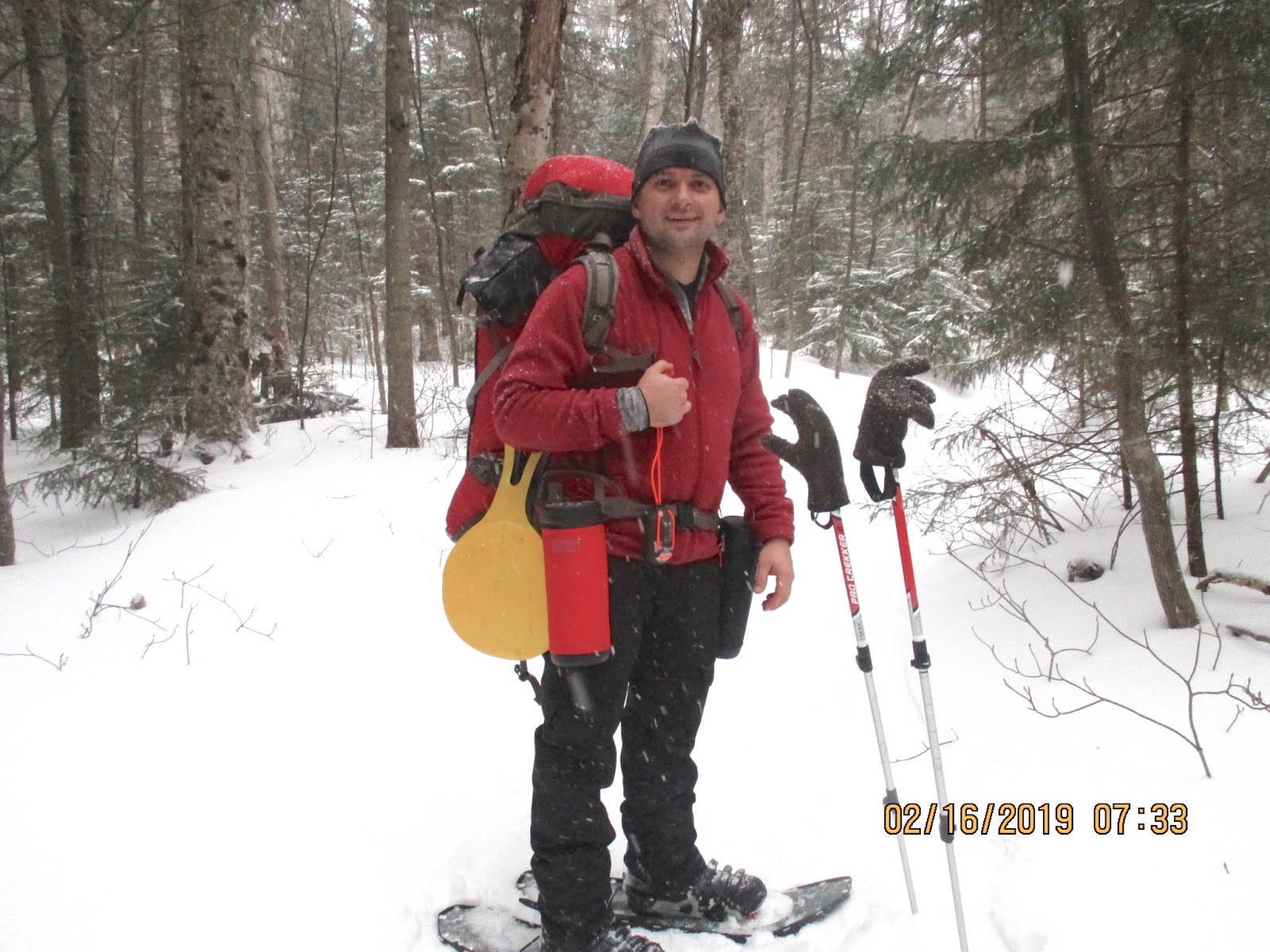
At the start of the trail there was packed snow, but because of the previous day's hike, I felt more comfortable in my snowshoes. Some of the guys opted to just hike in microspikes. 


The trail started out with a steady climb to the first intersection. We took a left to go 1.5 miles to the summit. Going right leads to Round and Dix Mountains. 

The new direction also revealed a drastic change in incline. Some sections of the trail were 30-40 degrees of incline, making a slow progress up the mountain. 


We took a nice break after a steep section with great views of Giant Mountain to the east. After this point the trail made a turn to the northeast which revealed some great views of Keene Valley. 


The trail continued at a steep ascent with sections of the trail having deeper snow and narrower walking space. On some steeper sections, I found it easier to hike on the sides of the trail. On the northern part of the mountain, there were some great lookout spots facing the Great Range and later facing Dial and Nippletop Mountains.  


The final push to the summit had very deep snow, steep terrain, and very low branches. We came across the first group of hikers on the trail at this point in the hike.


The views were absolutely worth the challenging ascent. It was magnificent to soak in the views of Dix, Dial, and Nippletop to the west with the Great Range to the northwest. After many photos, a water break, and changing gear to MICROspikes we headed back down the mountain. 


Butt sliding is the best way to describe the first 15-20 minutes of the descent. A little further down we came across the second group heading up. Using MICROspikes really helped on the way down because the trail was well packed down and there was no post-holing. We made it down safely in less then an hour. We meet the rest of the group at the car.

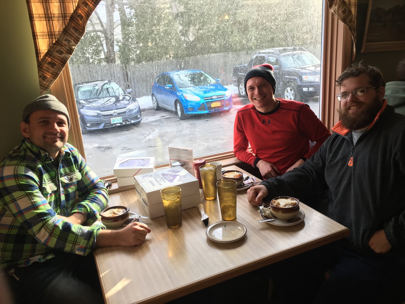
Once in Keene Valley it would be sin not to stop in at Noon Mark Diner for lunch and to pick up some pies and cookies for the road. It was a "full experience" to hike Noonmark Mountain and then eat at the diner.   


TRIP STATS: 
Distance: 5.1 miles round trip
Time: 4 hours including stops
Elevation gain: 2460 ft


Wednesday, February 20, 2019

FIRST WINTER HIKE: ALGONQUIN PEAK

Fourteen years ago when I first set foot in the Adirondack mountains, I never imagined that I will be hiking in the winter time. In fact, when I got married 11 years ago, I told my wife that "winter hiking is only for crazy people, and I won't be hiking then." But here I was hiking the second tallest mountain in New York as the first winter hike. My first summer hike was Marcy, which was the adventure that got me hooked. 

Over the last few years its become more convenient to spend the night in a cabin or hotel with a hot shower and a roof over the head instead of sleeping in a lean-to. We  rented a nice cozy lodge for 2 nights just off Route 173. It was a 15 minute drive to the ADK LOJ parking lot. 


On the final morning at the cabin we slept in and enjoyed some nice views of Whiteface Mountain from the back porch door. 


We were up at 4:30 am to make sure we had plenty of time to eat a nice hearty breakfast and have plenty of time to load the gear and drive to the parking area. The Vermont High Peak weather forecast looked promising but I have been on Algonquin twice and the weather is very much subject to change. We all hoped for some beautiful views at the summit! 


It was 11 degrees Fahrenheit at the ADK LOJ at 6:30 am and lightly snowing. The ranger made sure we were all aware that we needed snowshoes from the start. And so we started the first day adventure in the dark with headlamps to light the way. The day before we had reviewed the strengths of each hiker and the approximate order we would hike in. I have always been a medium paced hiker and I settle for the middle of the line. I was also one of the three first-timers on this winter hike. 


About 30 minutes into the hike, I began learning the skill of balancing the body temperature by either unzipping a layer or taking it off completely. Layering during the winter is a fine line because sweating too much increases the risk of dehydration and saturating the layers that will eventually freeze making one cold. 

Changing out gear (snowshoes to MICROspikes and then crampons) was also a learned skill in progress throughout the hike. I have to admit that if you have the proper snowshoes, it's much easier to just use them throughout most of the hike. My calf's had an immediate liking to the heel lift on my MSR Lightening Ascent snowshoes as soon as the incline of the trail increased. The heel lift bar  keeps the foot more level and improves traction while climbing by weight pressuring the rear traction. Calf fatigue was significantly decreased. It was very easy to switch back and forth simply by using the basket of the hiking pole to either pull it up or push it back.  


We made great progress to the trailhead, averaging almost 2 mph. Light snow continued as we hiked on. Some of the guys had switched to MICROspikes because the trail was well packed down with only a dusting of snow.


I love my summer and winter hiking poles because I learned how to use them well pretty early on. It is definitely a bicep/tricep workout throughout the entire hike but really helpful on the way up and even more so on the way down. A snow basket is a must for a winter hike because the mud basket plunges too deep into the snow. 


A little over 2 hrs we were at the MacIntyre Falls. It was a great place for a rest stop and a photo. 


Snow continued to get deeper on the trail and that also meant that the trails got tighter because one is hiking higher where the branches are longer. I had to brush off the snow from my fleece from time to time. 


At this point we broke up into 3 seperate groups due to some muscle cramping and fatigue. Dehydration is actually more an issue during the winter because its hard to gauge the amount of sweating due to layering. Some of the guys used a salt tablet, that also has additional electrolytes which can been taken every hour during the hike with plenty of water. The guys that took it said the cramping resolved.  


My bag appears deceivingly heavy, due to the fact that I used a sleeping bag to line the bag and keep all my supplies, food, and water from freezing. It worked really well and I didn't have any freezing problems. I also didn't use a camo pack but used Vapur collapsible water bottles. I had 4 liters of water for the entire trip and it turned out to be a perfect amount. The overall weight was 30 lbs, and it was 10-15 lbs overweight in my opinion. 

There are three very steep areas on the trail, two below the treeline and one is above on the final ascent.   


With a little break in the clouds and snow we had some great views of Wright Mountain and the valley below. 


It felt good to make it to the summit. The experience was great regardless of the views. Due to 40 mph winds and -20 degree temps, the time spent at the top was limited. We switched to crampons for the icy descent and heading back.  


On the way back down we ran into more team members making their way up so we hiked back up for a larger group photo. We were the second group to make it to the top. The third group was about 45 minutes behind us. However, it was a nice to communicate with the groups via walkie-talkies throughout the hike. Larger groups have the risk of breaking up and it was comforting to know the whereabouts and condition of all the team members.  


Once below treeline we stopped for a few minutes to eat some lunch and drink some warm tea. When I reached for my crackers, sausage and cheese sandwiches, I found that the cheese had melted. Throughout the trip when I reached into the sleeping bag, it was a balmy 85 degrees. 


After lunch we heading back down with a couple rest stops along the way. There were a couple places that on the way down when butt sliding was the best and safest way down. I found that using an actual butt sled is not really necessary as long as you are wearing a bib or have a coat with a snow skirt. A butt sled however will allow you to go faster and will protect your butt a little more. 


Even though we were descending, it got hotter again and then another layer had to come off. 


The entire group made it safely to the summit and back to the parking lot. It turned out to be a great day for hiking.  I am grateful to all the guys who helped me prep and made sure that I got the proper gear.  


TRIP STATS:
Distance: 8.8 miles round trip
Time: 9.23 hrs total with stops
Elevation gain: 4117 ft