In February 2019 I did my first winter hike and to say that I was "hooked" would be an understatement. There are clearly many great benefits to hiking in the winter and I have experienced them all. This trip was very unique because there were opportunities to combine several forms of hiking and even skiing.
Late afternoon on Friday, along with Matt, a colleague and friend of mine, we made our way up to Tupper Lake where we stayed at the YoungLife camp. It was nice to get a tour from someone who attended the summer camp as a young person, then worked on staff and is currently volunteering as a medical provider during the summer. The entire camp is located on the lake, on a gorgeous 40 acre wooded lot. All of the buildings are well decorated and very home-like.


It was an hour drive from Tupper Lake, and when we arrived at the toll booth on the Memorial Highway, we were surprised to be the only people there. We gathered our gear and were hiking on the road by 0740. It was relatively "warm" in the low 20's but there were nice gusts of winds that occasionally kicked up some fresh snow.


I wore snowshoes from the start, and as we ascended further up it was nice to have them for the deeper snow. I also greatly appreciated the heel assist built into the snowshoes. Matt had the right idea of skinning up the mountain. The higher we got the darker it got with heavier snowfall at times. On the ascent I was also towing a pair of ski's and boots for the descent. About 2.5 miles in they were definitely a little more cumbersome because the set up didn't work well in deeper snow. So in order to keep the ski's lined up I walked along the border where there was more ice.


There were a couple times that we really thought that it was going to clear up and I really hoped for some great views at the top but the clearing never came at the right time.

On the way up we briefly met Rich, who travelled from Pennsylvania. He is a outdoor enthusiast
and blogger as well. Rich made great progress up the mountain and made it up to the last turn before the summit and then sledded a couple mile back down the toll road before his sled broke apart into several pieces.


We made good progress and felt great at the first hairpin on the toll road. I could feel the summit's presence hiding in the clouds and I couldn't wait to get the ski's off my body.


We finally had the wind on our backs and we came to the second hairpin in the road. By that point most of the snow on the road disappeared except for a few inches on the left side so we decided that this was a great place to stash the skies and continue to the summit.

At the trailhead for the steep 500 foot final ascent, I got my first cramp in the right quad. After a brief break and stretch we also felt the first chill of the strong summit wind. We quickly put on the hard shell outer jackets and changed out the gloves for warmer mittens.

The eerie looked of the castle loomed before us as everything seemed frozen in time with amazing snow and ice art on the walls. Too bad it was so cold, one could walk around and take great photos of the unique designs.


I caught a great photo of Matt appearing as though he was a ghost of a hiker. This was also the spot where we put away the snowshoes and put on the microspikes. It's simply dangerous walking up the stone stairs in snowshoes.

The sun only cast one quick glow and it was gone behind the thick clouds. And at last we made it to the top. When hiking in low visibility it's difficult to appreciate time because it's difficult to gauge the elevation gain.

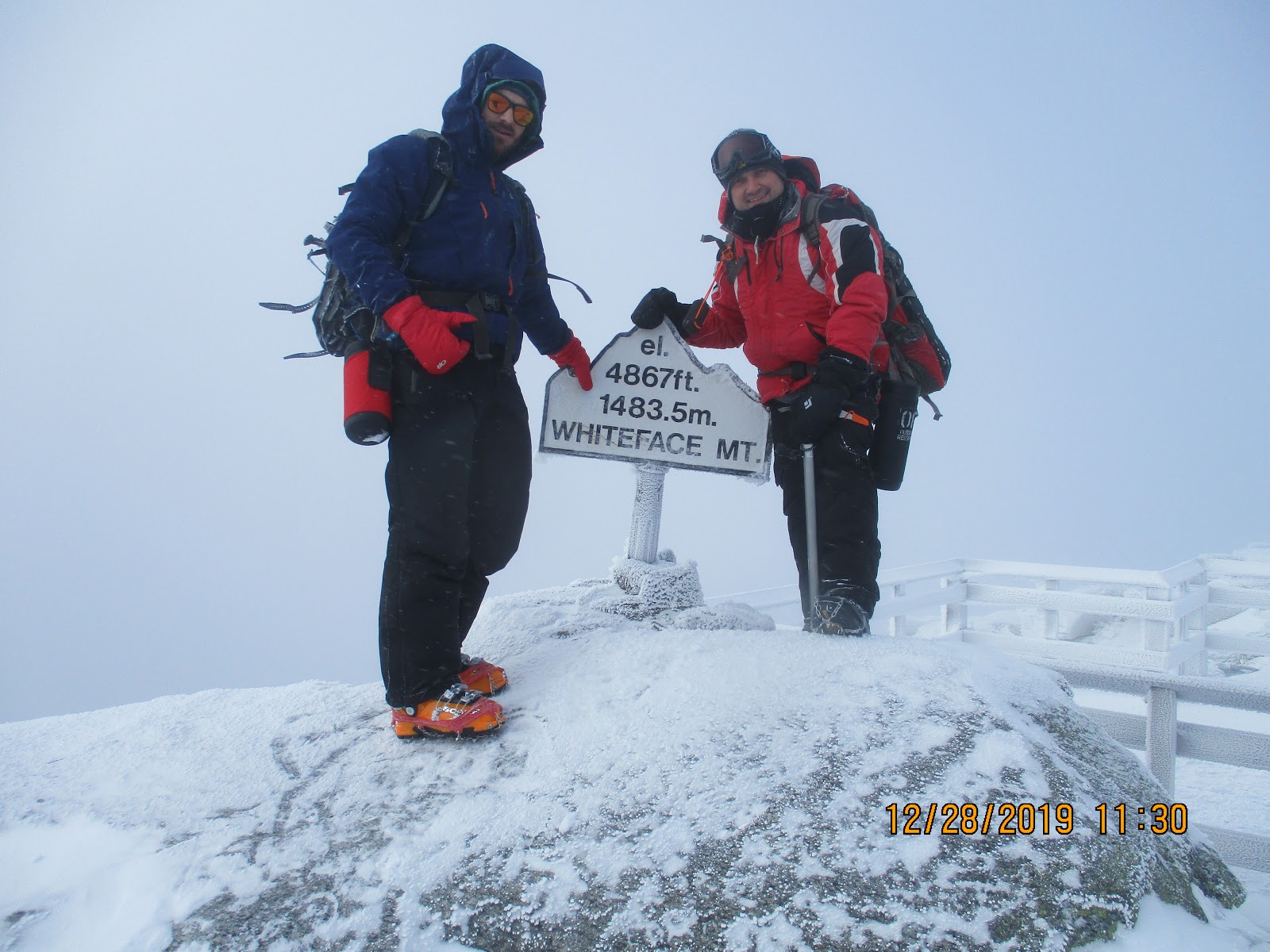
The observatory and railings had little snow and ice formations that looked like feathers and I really wanted to take more photos but at times I felt like I was going to loose the camera due to high wind gusts. The forecast that morning from the National Weather Team predicted 45 mph winds and -7 degree temperatures. And that is exactly what we it felt at the summit.

We knew we were the first at the summit that day because the sign was snow covered and frozen. But after a little dusting we took the mandatory summit photos and were ready to leave when a group of 4 hikers from Quebec made it to the top as well.

On the return trip, we opted for the shorter and steeper descent along the ridge back down to the road. We met a few more groups coming up.


I decided to step off trail to take the above photo and sunk to my hips, surprised at the snow depth. Back at the road intersection we saw a crowd of 8 hikers taking turns climbing the ice formation at the start of the trail.

Matt couldn't wait to get off the ridge and so we paused for a short break and lunch just past the stone wall beneath the road. I enjoyed some goat cheese with sausage, crackers and pickles. I always bring some hot black tea for lunch because the combo is so delicious and warming.


After lunch the clouds gave way and the sun was out but the air was still very crisp. We made really good time as we headed down to Mt. Esther. There were several flat areas, that during the summer are very wet. The quad cramp only reared its ugly head during some of the steeper sections.


Once we turned left at the Esther trail marker we entered some spruce trees that made for a delightful yet nippy walk in the woods. Again I was hoping the clear skies would hold until after we left the summit. But in rolled the heavy clouds and the beautiful views of Whiteface that we could have had were gone.


At the summit we met up with another hiker "enjoying" the views and struck up some small talk. I enjoyed some half frozen gummies while we stood around.


As we headed back up to the toll road to pick up our ski's the sky cleared up again and we had to pause to enjoy some scenery and stretch the quads again. Despite all of the salt/electrolyte content via "salt pills" and drinking more water the quad cramp still persisted. As we made our way up the steeper sections on the final lag of the ascent to the road the only thing that helped my cramp was prayer.


We had to stop for more photos and we even saw Mt Mansfield in Vermont during this clear up. But the winds prevented us from standing around too long.
Back at the stashed ski spot we quickly changed gear and started the descent. At the second hairpin we saw the clear Whiteface summit and stopped for a photo.


Even though at this point both quads were burning, I was excited to get down the mountain in an expedited fashion. I definitely held Matt up as I slowly weaved down the road. As we neared the bottom we passed several people out for a walk with kids and dogs. The descent took 30 minutes, covering 5 miles, which was record time for me.

Overall I was very happy for the experience that I may not repeat again in the near future. There aren't that many roads on mountains and my ski skills aren't good enough for narrow trails lined with many "tree hugging" opportunities.
Total Distance: 14.8 mi
Total Time: 8 hrs
Elevation Gain: 3,930 ft

