There is are several reasons to hike in the Adirondack high peaks but the fall attracts many people for the beautiful foliage. With another couple (Sarah and Jarod) along with my wife and I, we decided to head north and enjoy the beautiful cool fall weather and of course the leaves.
On the way up to the mountains and on the return trip we traditionally stop along the way to eat at a mom-and-pop restaurant. Every time we go we try to change it up. This time we stopped by O.P. Frederick's. They have a great menu that is reasonably priced and when we sat down at 5:30 pm we just beat the crowd. It was about one hour from Keene Valley.


It was another busy weekend in the High Peaks Region because the weather was going to be really nice. So the only place that had a vacancy was the Ausable Inn in Keene Valley. We stayed there several times before, and its a very inexpensive place to lodge for hikers. Its on the same street as the Garden parking lot. Its definitely a popular spot because we encounter many hikers every time we are there.

The night before the hike, I asked the waitress at the restaurant located on the first floor of the Inn, about making some coffee. She showed me how to use their machine and I was able to brew some coffee for us and several other hikers. After a breakfast of bagels and coffee/tea we made our way to the ADK Loj. When we pulled into the lot at 6:30 am, and payed a $12 parking fee for the day, we saw lot that was almost full.

From the parking lot, we had to walk back towards the entry booth and to the left of it is a 3-4 car parking area with the above sign on the right side. Once again, Street and Nye are "unmarked trails" and therefore we didn't have any markers to follow except for landmarks and cairns. From the start, attention to details was important. The trail heading towards Indian Pass runs heads west on the northern shore of Heart Lake.

At 0.6 miles, we turned right onto the Old Nye Ski trail. In a very short 0.3 miles there was fork in the road, and we veered left. The trail then began a gradual descent to the brook at about 0.9 miles or about 40 minutes from the parking lot.
The herd path turned right to follow the east bank. At this point there are several side trails that cross over the brook but we kept going on the main eastern trail that eventually lead to the Indian Pass Brook. Later we realized that those side trails were early points of crossing the brook because it is much wider and deeper further downstream.

Nevertheless, at 1.5 miles from the Loj we came to the brook which was much wider and deeper at this point. We ran up and down the banks a couple times in search of higher ground to cross but it was futile. So we simply decided to remove our boots and cross over with bare feet. The water was super cold and halfway across our feet became numb. It was definitely nice to have some trekking poles for stability.

On the other side we dried our feet and geared up again. We never saw the cairn on the other side like other bloggers and books described. There was a well beaten path that split left, going up a steep embankment and to the right which went in the same general direction just on lower ground. The upper trail is probably used during the wet season or in the spring when the brook is in the flood stage.

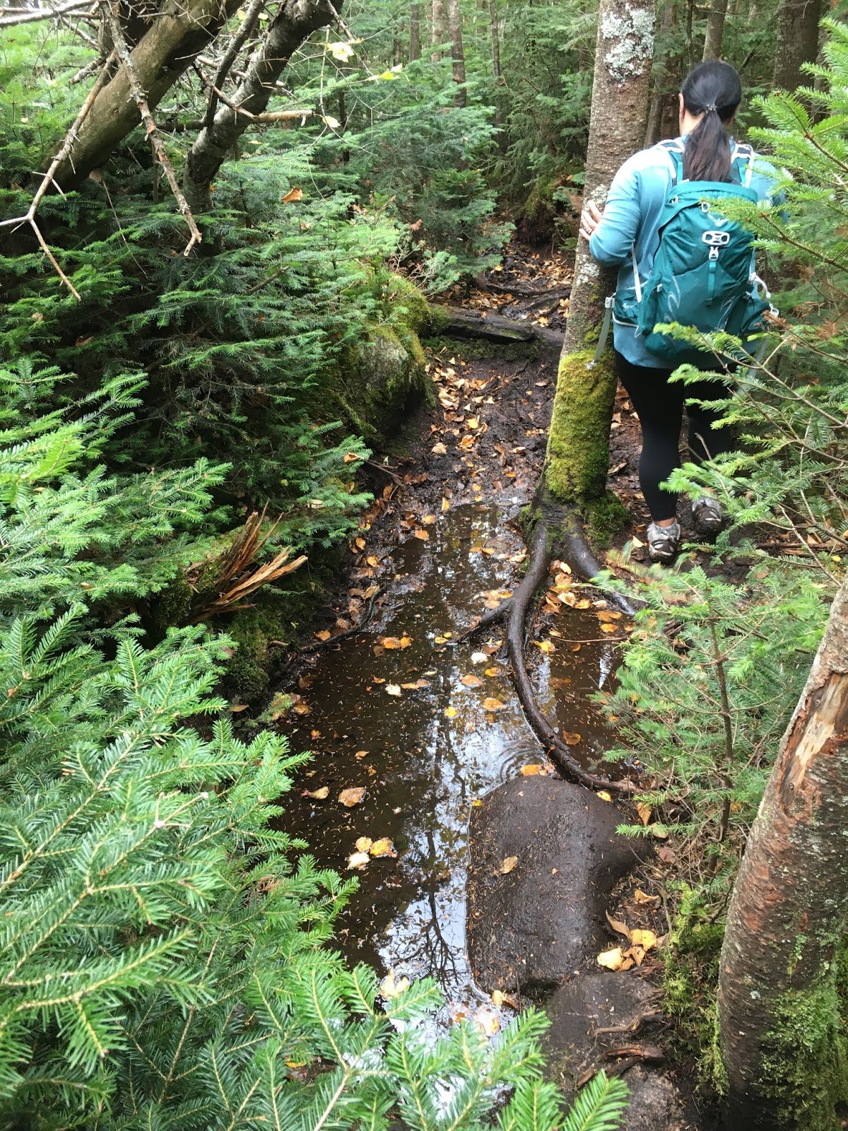
The trail continued to meander deeper into the woods and further away from the brook. It then went around an open tributary from the west. The stream as seen the photo below guided much of the trail.

At some point the trail crosses over to the north bank of the stream. Shortly after the crossing we walked past rusty remains of several metallic items such as a bobsled, water jug, and other unidentifiable objects.


At about 1.8 miles from the Loj, and about 1 hour and 15 minutes into the hike there is a moderate ascent. From this point on the trail swings back and forth across the stream. This spot was one of the wet areas on the hike. The way back the stream washed our boots really well.

At 2.8 miles (about 2 hrs 15 min.) there is a flat area on the Nye shoulder. Then it hooked right and it the trail turned really wet with several boggy areas.
As we continued on we came to the steepest section of the trail and there were some open rock areas that gave you some glimpses of the altitude gained.


As soon as the ground leveled out again, at the 3.3 mile mark, a cairn marked the split. There is also a tree that has "N" marked on top with an arrow above it indicating that is the direction to Nye. The second marking is "St" for Street with an arrow pointing to the left. We decided to do Nye first. But before we took off we noticed there was a leaning pine with a dollar bill stuck in it.


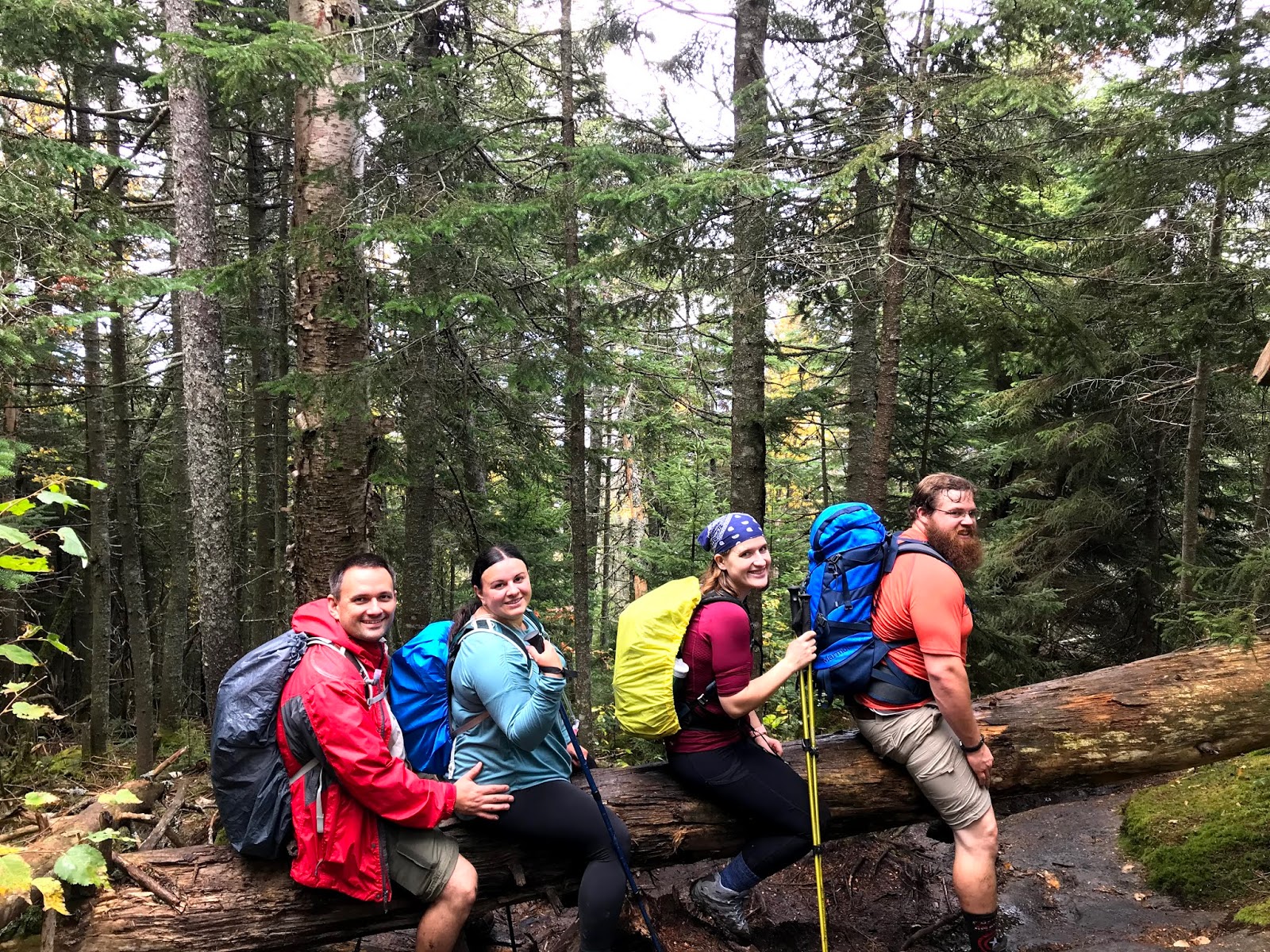
In about 12 minutes we made it to the summit of Nye. We were the only ones there at first. As we were getting ready to leave another couple arrived and shot a photo of our hiking party.


The flat areas on Nye and Street were really wet and this photo shows the deep puddles.
Putting one muddy boot forward, we trekked through the wet areas.

It took us about an hour to hike from the summit of Nye to the summit of Street. There were more bad spots than good that required us to slow down, use the trekking poles for balance, and jump around the boggy spots. But nevertheless it was nice to make it to the summit of Street by 11:08am.


We enjoyed a 30 minute break at the top. Unfortunately, the weather turned sour after about 10 minutes, it started to rain with 20-30 mile/hour wind gusts. Out came the rain gear. We then proceeded to take some photos and then wondered over the look out. There are several paths that scatter in every direction at the top but the path that leads to some decent views hooks to the right.

The wind was really strong on this side of the mountain and we didn't linger too long as we started to feel the cold. The views were still nice!


On the way down we had to take a photo on one of the dozens of large blowdown trees that we had to get around. It definitely slowed us down. My poor wife got all kinds of bruises on her thighs as she had to get creative in order to get over and around these obstacles.
As a result of the all of the rain that we had received earlier in the day, all of the rocks were wet, along with the huge trees in the way. It was a bit slippery on the way down but nothing to write home about.
It was a great trip overall as we enjoyed the company of Jarod and Sarah. Once again, we created great memories of our adventures in the ADK high peaks.

TRIP STATS:
0652 Started at Loj
0955 Split in trail (S & N)
1005 Nye Summit
1012 Left Nye summit
1108 Street summit
1142 Started descent from Street
1500 Finished at Loj
Elevation Gain: 2300 ft
Total Distance: 8.5 miles
Total Time: 8 hrs with stops


No comments:
Post a Comment