Almost a month into summer, Upstate New York finally had a weekend that felt like summer, 80's and sunny. This also meant it was a good weekend to hit the high peaks in the ADK. So with a good weather forecast Andrey, Dima and myself set out on a day trip to the Dix mountain range. This was my first time venturing out to the North Hudson area, and therefore it felt more adventurous.
After doing some blog browsing, several hikers recommended getting to the Elk Lake parking lot before 7 am because it fills up fairly quickly. And so we left my house at 3:30 am. It's nice to drive early in the morning, with minimal traffic. We took the North Hudson exit off 87 North at 6:30 am. At the ramp we made a left turn on Blue Ridge Rd. After 4 miles we made a right onto Elk Lake Rd at the Elk Lake Lodge sign. The road is roughly paved for a couple miles with plenty of pot holes which then turns into an all gravel road. Eventually you drive up to a house on the left and then the gravel road narrows and goes over some hills for 2 miles to the parking on the left. There was a wooden sign standing in the road across from the house which stated, "parking lot full, park here." We decided to drive up the road anyways just in case we can save an extra 4 mile hike. As it turned out the parking lot wasn't even half full.


The hike started out really flat with gentle slopes for almost a mile. But because of recent rains, there was a good stretch of trail that was very muddy. In fact recent hikers chose to walk on higher elevations on both sides of the mud. We also noticed the number of streams and brooks that crossed the trail therefore contributing to some of the wetter areas. There were several bridges over larger brooks. With the increased amount of standing water, also meant a lot of bugs in those areas.


Just a little over 2 miles we came to the Slide lean-to which also has a trail that leads to the Macomb slide. There was quite the group of people just getting up at the lean-to that we decided not to stop by.


In about another mile we came to the two cairns marking the Lilian Brook trail leading up to the col between Hough and South Dix. On the way down from Hough we came down this trail.


We came to this official yellow marker on the tree that indicated the Buckhorn trail. There was another marker on different tree heading north which indicated the Hunters Pass trail.

For a short distance the trail followed a river bed which allowed for some significant elevation gain. We were 2 hrs into the hike at this point so we took short snack break.


The humidity and heat of the day caused for excess sweating. During the course of the hike I drank almost 5 liters of water. I was grateful to have a water filter on this trip or else it would have been a parching descent.


Nearing the Beckhorn we had a few rock scrambles/ climbs but with some thought and proper foot placement it was easily accomplished.


Looking back at the ridge that we just hiked

A rock outcropping just before the Beckhorn

The final ascent to the prominent rock on the Buckhorn

From the Beckhorn the summit of Dix was about 70-80 yards via a narrow brushy trail. Once at the summit we had a nice 30 minute break. A PB & J sandwich always tastes better on the mountaintop.
There was another hiker who got to the top just before us via the Route 73 trail. He thought the trail was a pleasant hike with several areas of exposed rock which allowed for great views.

Looking Northwest

Looking Northeast from Dix summit

Dix marker


Foreground: Nippletop Background: the Great Range

Background: Bigslide mountain

Just before starting back down towards Hough, another hiker and her two dogs, Ausable and St. Hudson, reached the summit. We spent a few minutes talking about the hike and then parted ways.


Beckhorn from Dix summit


Dix from Buckhorn
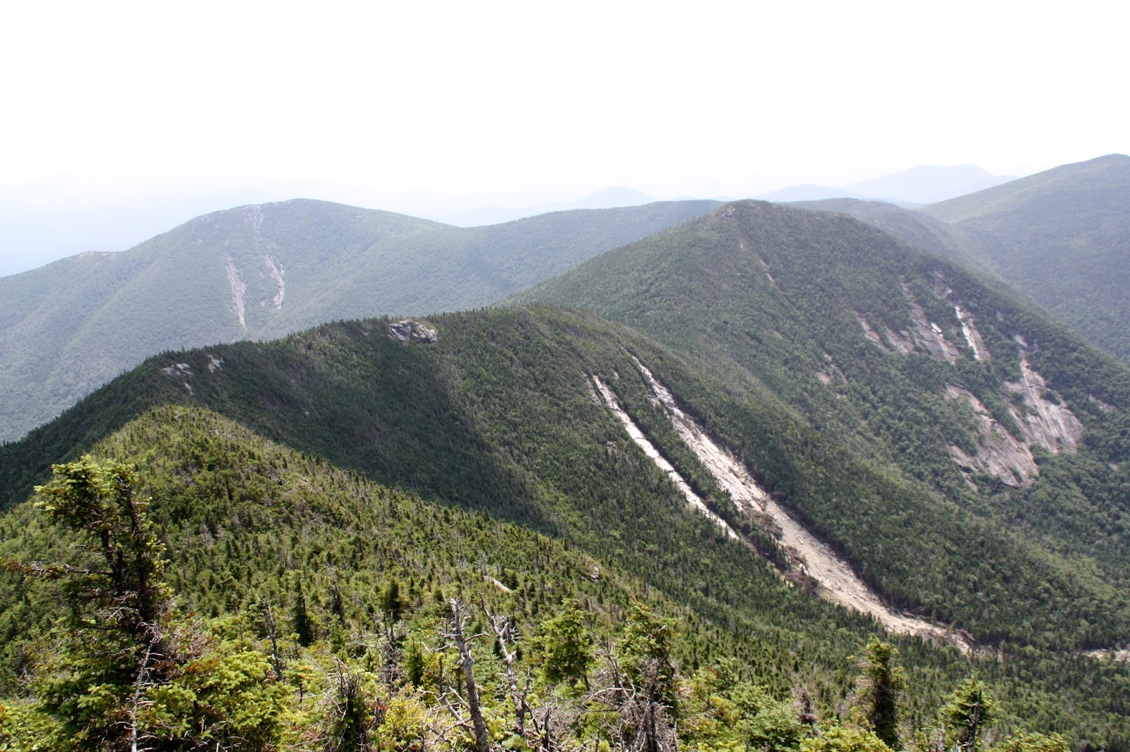
The ridge leading to Hough
In the photo above, the rock outcroppings along the ridge allowed for some great views of Dix mountain and the terrain down below, especially the slide.
A final look from high up at Elk Lake as we started out towards Hough.

Trip Timeline:
July 12, 2015
Elk Parking Lot: 7:03 am
Slide Lean-to: 7:50 am
Lilian Brook: 8:14 am
Dix trailhead: 8:49 am
Beckhorn: 10:35 am
Dix summit: 10:43 am
Departed Dix: 11:32 am
Hough summit: 12:23 pm
Hough/South Dix col: 12:55 pm
Lilian Brook trailhead: 2:03 pm
Parking lot: 3:20 pm
Hike Stats:
13.2 miles
8 hrs 17 mins
2800 ft elevation gain
Video of hike to follow soon!
No comments:
Post a Comment